One tactical picture, shared by everyone on scene.
Every appliance at the incident is looking at the same map, the same size-up and the same board — updated in real-time, and recorded for the report afterwards.
The fireground, marked where it actually is.
One map, shared by every tablet at the incident. Satellite or street, flat or tilted, with 3D buildings when the shape of a roof is part of the problem.
Everything placed on the map is stored in latitude and longitude, never in screen pixels. That is why the officer on a tablet in the driveway and the duty officer on a browser in the station office are looking at the same ground at whatever zoom each of them chose, and why a symbol dropped by one appears on the other without anybody describing it.
The map is as much the incident’s memory as its display. Every marker, zone and measurement carries who placed it and when, and it is all still there in the record after the job.
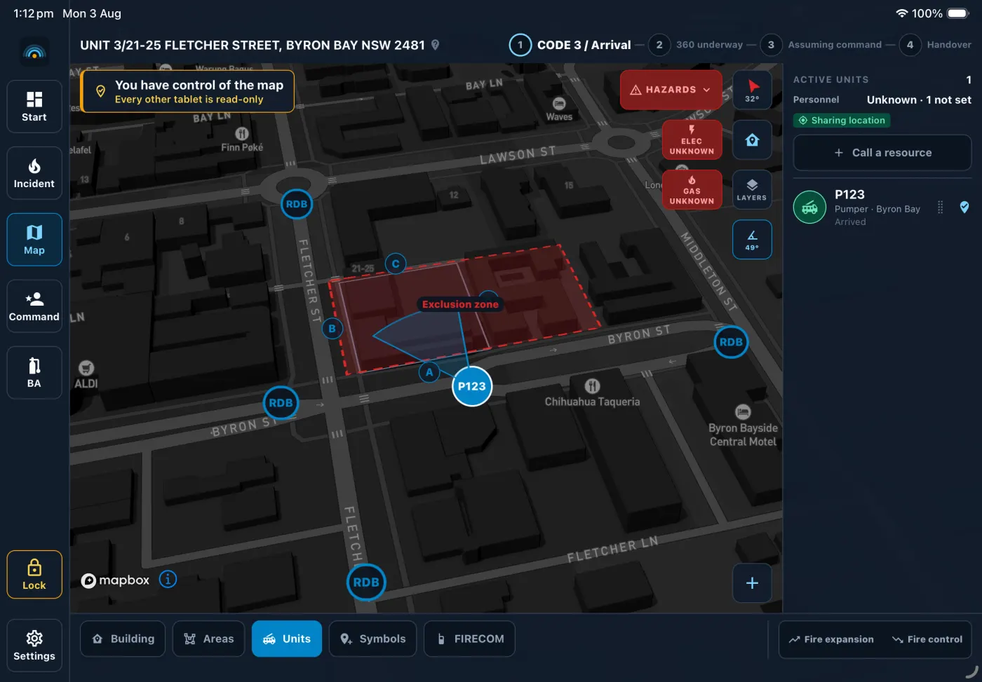
Hazards and tactical symbols
Drop a hazard, an exposure, an appliance or any tactical symbol on the spot where it exists. Utilities, roadblocks and the rest of the palette are the symbols already used on a tactical board — placed on the ground rather than sketched beside it.
Exclusion, collapse and control zones
Exclusion and collapse zones, and hot, warm and cold circles for a hazardous materials incident. Set once and visible to every tablet at the incident from that moment — rather than described over the radio and then redrawn slightly differently in six heads.
Distance and area, measured
Measure a setback, a hose lay or the footprint of an involved building without leaving the map. The number comes from the geography rather than from an estimate made through a window.
Sides A, B, C and D
Place the building and set one thing: the bearing the Alpha face looks toward. On-Scene derives Bravo, Charlie and Delta from it. If no building has been placed, a marker says the side is not set rather than guessing one — that letter gets read aloud over the radio and lands in the timeline, so a confident wrong side is worse than a blank.
Photographs and audio notes
Attach a photograph or a spoken note to a marker. The reason something was called a hazard survives the crew that called it, and the attachment comes out with the record at the end.
Units, live
Appliances are positioned on the map and their status is set from the truck it belongs to. Every tablet at the incident sees the change as it happens, over a private channel that only that incident’s own units can join.
Code 3 and the 360, in the order the job happens.
The form the officer in charge is filling in on the way to the job and while walking around the building — and the FIRECOM message that comes out the other side of it.
An incident moves through stages a crew already names out loud. Each one changes what the form asks for and what the radio message says, so nothing is entered twice and nothing has to be entered before it could be known.
The 360 is the walk right around the building. Its checklist was written by a serving firefighter, in the order things are actually observed: five sections and forty-five findings, arranged the way the walk takes them rather than the way a form designer would group them.
Nothing on the 360 is pre-ticked, and the size-up guesses nothing on your behalf. Fire size, levels and occupancy start unset rather than at the most likely answer — those three are read aloud to FIRECOM, and an incident where nobody touched them must not broadcast three facts that no human stated.
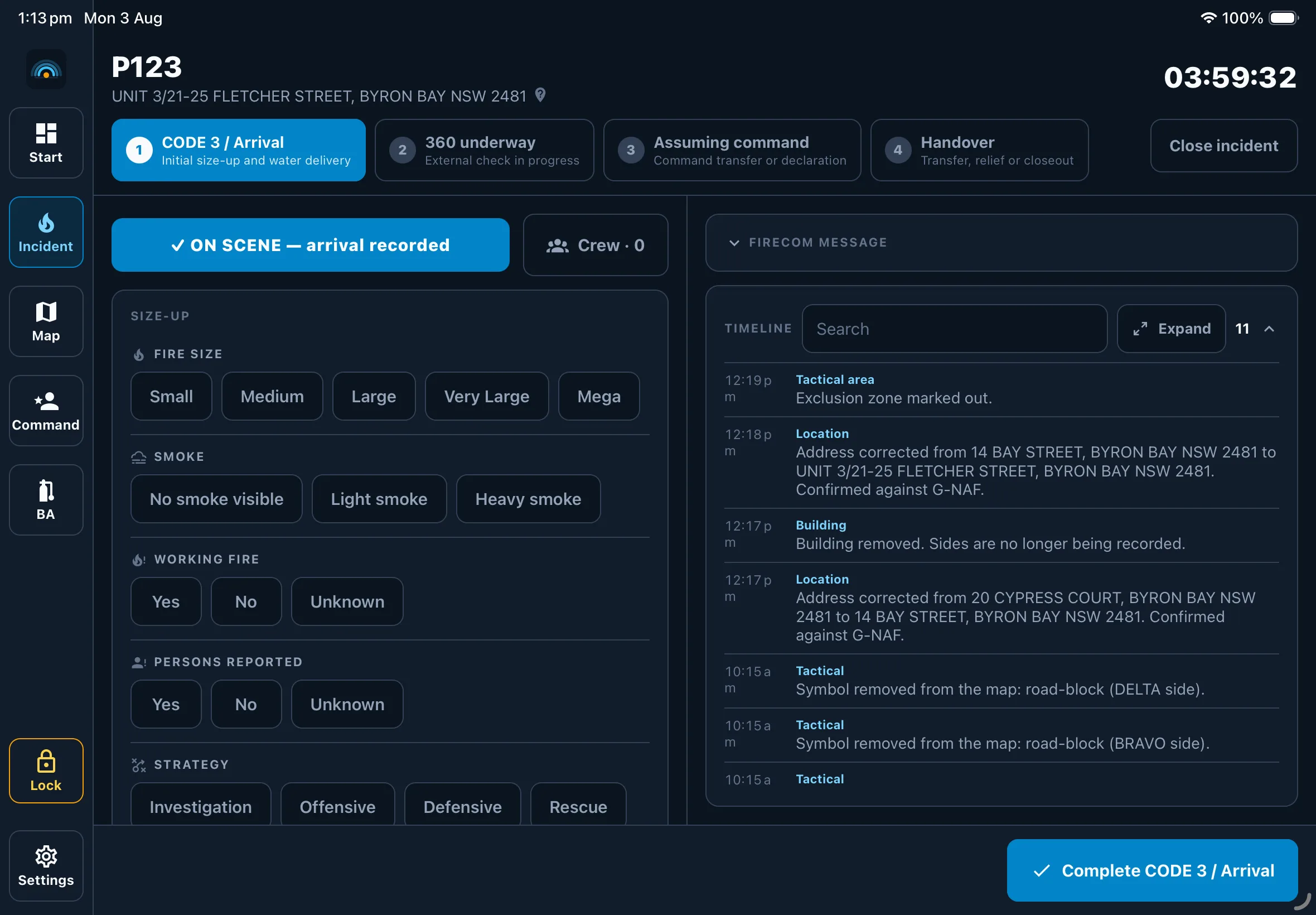
The size-up already entered becomes a message in the order it is transmitted. It is a draft: editable, reviewed by the officer sending it, and never transmitted by the app.
FireCOM, P714 Code 3 at 12 Jonson Street Byron Bay. P714 will be known as Byron Bay Command. We have a large structural fire. Persons reported: yes, 2 adults, last known first floor bedroom. Current strategy is Offensive. Over.
All FireCOM message drafts are editable and must be reviewed before use.
Who is wearing a set, on what task, and with how much air.
The BA board, on the same tablet as everything else — so entry control is not a separate piece of paper that somebody has to reconcile with the incident afterwards.
Wearers go on the board with their cylinder pressure and the time they went on air. Tasks are allocated from it and the rapid intervention team is designated on it, so “who is committed and who is in reserve” has an answer that is looking back at you rather than one that has to be assembled.
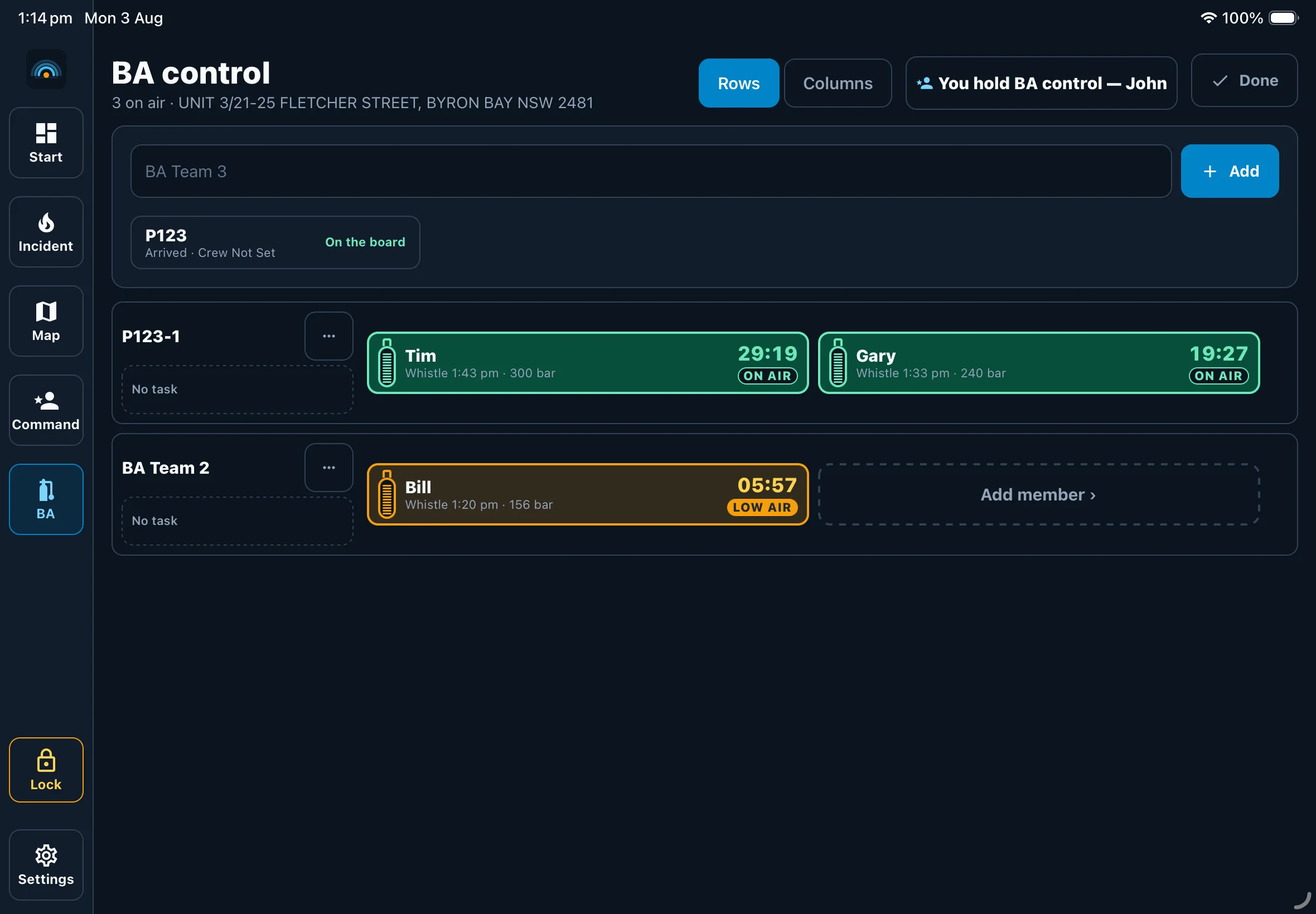
The board
Every wearer, their set, their cylinder pressure and their time on air, in one place that the incident controller and entry control are both reading.
Tasks and RIT
Allocate a task to a wearer, and designate the rapid intervention team from the same board. A crew committed and a crew held in reserve are different things, and the board shows which is which without anybody counting.
Alerts that are acknowledged
An alert sent to wearers is acknowledged by each of them, so the board shows who has heard it rather than who was told.
Who is coming, who is here, and who is in charge.
The resource board tracks every appliance at the incident — and it is where command comes from, because on a fireground arriving is command.
Each appliance has its own tablet, signed in as that appliance when the station is commissioned. Nobody signs in at turnout: a retained crew arriving at the station and responding has no time to, and a login screen at the one moment it cannot be answered is a login screen that ends up being shared.
Attribution is a separate problem, and it is solved separately — a one-tap crew sign-on when the incident starts, and a request-and-acknowledge protocol for command. Making the first harder at turnout would not have solved the second.
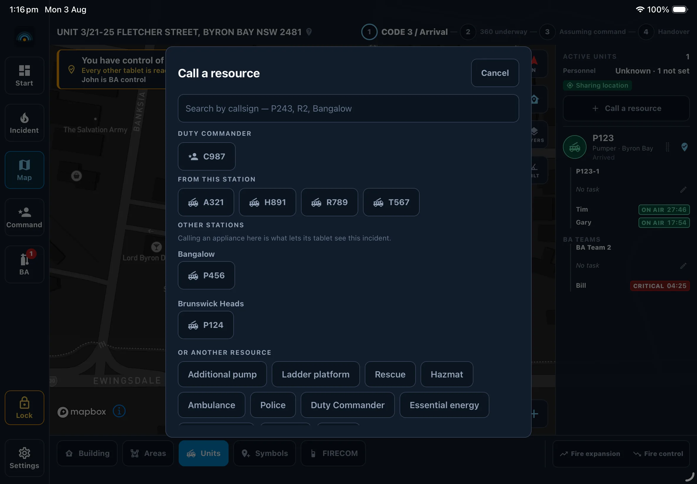
One tablet per appliance
Status is set from the truck it belongs to, by the crew on it. What comes out at the end is a record of who attended that nobody had to reconstruct afterwards from memory.
Arriving establishes command
The first appliance to arrive holds command, whatever station it came from, until command is transferred and acknowledged. Arrival times are stamped by the database rather than sent by a tablet — the order things happened in decides who is in charge, so it is not something a wrong clock gets a say in.
Mutual aid by invitation
A station sees nothing of another station’s incidents until that incident’s controller calls it in. There is no list of nearby jobs and there never will be: a station should not be able to add itself to somebody else’s fireground.
Crews already walk these buildings. The plan should outlive the drill.
A pre-incident plan is the same tactical map, taken to the drill, so that what a crew works out standing in the yard of a high-risk site is still there when the job comes in at two in the morning. Nothing from a plan is copied into the incident record: it sits beside the job as a reference, and the record still says only what a crew entered on the night.
A plan is built on the map the fireground already uses — the same symbols, the same zones, the same lettered sides — because a crew asked to learn a second tool on a drill will not reach for it at a job. Where the appliances go and where staging is, the access points, the hydrants and the static water supply, the hazards and the utilities, photographs and tactical notes: all of it placed on the ground it belongs to, in latitude and longitude, exactly as an incident’s own map is.
When an incident is later started at that address, On-Scene recognises it and tells the incident controller a plan exists. An address that matches is reported as a match; a plan at a site nearby is reported as nearby, with the distance, because a plan for the building next door is useful and is not the same thing. The product does not turn an uncertain answer into a confident one anywhere else, and it does not start here.
A plan carries its age wherever it is read. One that nobody has looked at since the tenancy changed hands is worse than no plan at all, so when it was last reviewed is part of reading it rather than a detail in a corner.

screenshots/preplan-ipad.pngWater, access and where the trucks go
Appliance positioning and the staging area, the access points, the hydrants and the static water supply — marked on the site itself rather than described in a folder. A plan holds what a crew can only learn by standing there: which gate is locked, which side the booster is on, where an appliance cannot turn around.
Recognised at the address
Start a job at an address a plan covers and On-Scene recognises it and offers the plan to the incident controller rather than waiting to be asked for it. The plan opens beside the incident as a reference: it changes nothing on the map the crew is working on.
The station’s plans, and nobody else’s
A plan is readable across the organisation that wrote it and editable by the station whose ground it is on. A crew called to the job by its controller will see the plan for that job, through the incident and the same way mutual aid sees everything else — never as a list of another organisation’s sites to browse.
The tablet in the appliance, the phone in a pocket, the console in the office.
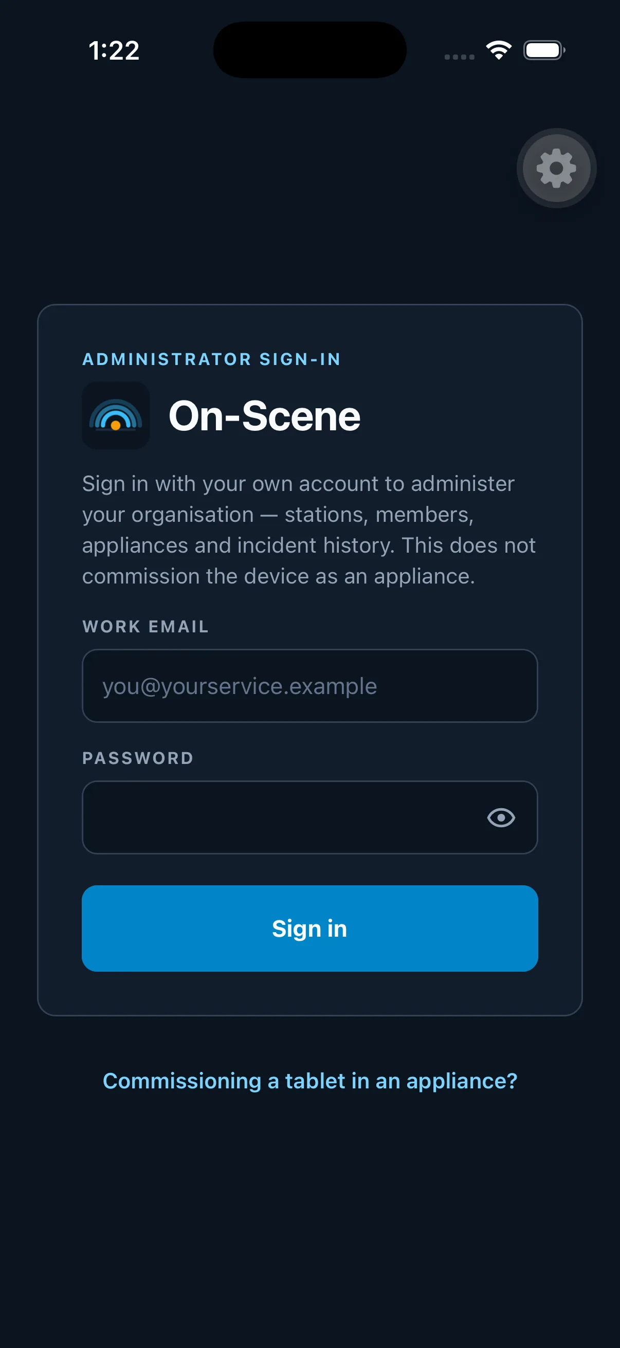
On-Scene runs on iOS and Android, on phones and on tablets. The tablet bolted into the appliance is where a fireground uses it; the phone is what a sector commander or an on-call officer already has on them.
The fireground app is built to be operated through a structural glove, in glare or in the dark. Nothing on it is smaller than a 44-point target, contrast is set for direct sunlight rather than for a monitor, and every state is a word and a shape as well as a colour.
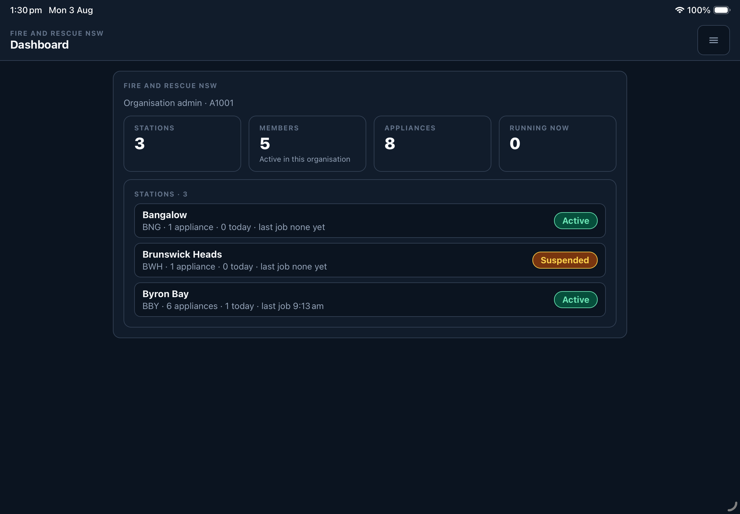
The admin portal is an ordinary browser, for the desk half of the job. It is read-only over anything running right now — not by convention but by construction: the incident’s own tables refuse a write from a person rather than an appliance, so an account in the office cannot change a fireground it is watching.
A live, read-only view
Watch an incident as it runs from the station office, or from anywhere with a browser and an account. The same map, the same board, the same timeline — and no way to reach in and alter it.
A map of everything at once
Stations, appliances and whatever is running right now on one map, for whoever is holding the picture across an agency rather than one job.
The incident record, exported
When it is over, the whole incident comes out as a report to read and a complete archive to keep — the timeline, the map, the worksheet and the attachments, in a form that can be handed to somebody who was not there.
Every incident type, on the tablet today.
Every incident type here opens on the tablet today — shown as one list, because you should know exactly what you are buying.
See On-Scene on your own fireground
A short walkthrough with the people who built it — the size-up, the 360, the tactical map and a handover, on your ground rather than a demo suburb.